| The new Woldipedia with 5e content is available here |
File list
This special page shows all uploaded files.
| Name | Thumbnail | Size | User | Description | Versions | |
|---|---|---|---|---|---|---|
| 09:14, 17 February 2024 | Windborne Hills.jpeg (file) | 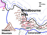 |
1.1 MB | Cayzle | A map focusing on the Windborne Hills and some of the small kingdoms in it. | 1 |
| 21:36, 20 August 2020 | Culverwood.jpg (file) | 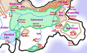 |
210 KB | Cayzle | A new, more accurate Culverwood map | 2 |
| 20:19, 23 April 2020 | WH-Map.jpg (file) | 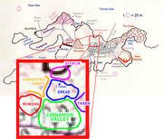 |
148 KB | Cayzle | A rough map showing the location of Cinnamon Valley and its neighbors. | 1 |
| 17:57, 18 November 2019 | Cinnamon.jpg (file) | 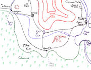 |
356 KB | Cayzle | 2 | |
| 16:26, 17 April 2017 | TaurIslesLogoBigger.jpg (file) | 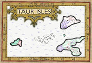 |
60 KB | Cayzle | Logo for the Taur Isles game, launched May 2017 | 1 |
| 16:22, 17 March 2017 | Taur Isles.jpg (file) | 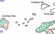 |
48 KB | Cayzle | Taur Isles per a Jerry original map. | 1 |
| 14:57, 16 March 2017 | Midde-Seas-Distance-Chart.gif (file) |  |
21 KB | Cayzle | Update to the original chart that fixes a dumb typo. | 2 |
| 12:41, 26 January 2017 | LionfishPainting.jpg (file) | 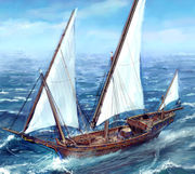 |
272 KB | Cayzle | A painting of the Lionfish, the ship of the Bonetown Crew of adventurers. | 1 |
| 03:21, 12 July 2015 | NewWLAlogo.jpg (file) |  |
28 KB | Cayzle | It is my hope that this hideous image will inspire a real artist to create a better version! | 1 |
| 17:09, 9 February 2015 | BonetownAreaMap.jpg (file) | 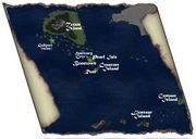 |
137 KB | Cayzle | Map of the seas and isles around Bonetown and Rum from Totem Island to Centaur Island | 1 |
| 18:44, 29 December 2014 | DirtCity2014.jpg (file) | 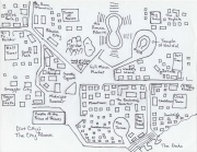 |
237 KB | Cayzle | A map of Dirt City Above | 1 |
| 07:08, 2 December 2014 | 2014DirtCityAbove.jpg (file) |  |
120 KB | Cayzle | New smaller version of the Dirt City Above map | 2 |
| 01:27, 2 December 2014 | DirtCityAbove2014.jpg (file) | 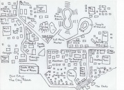 |
654 KB | Cayzle | This 2014 rework of Dirt City Above was created by Kathy for the Crescent Moons Trading Company game. | 1 |
| 06:50, 18 February 2014 | Tree-of-Parting-logo-wiki.jpg (file) |  |
245 KB | Cayzle | Tree of Parting game logo designed to match the wiki. | 1 |
| 21:43, 17 February 2014 | Tree-of-Parting-logo.jpg (file) |  |
84 KB | Cayzle | A larger version of the Tree of Parting game logo | 1 |
| 12:28, 14 February 2014 | Agents-of-the-Fist logo.jpg (file) |  |
43 KB | Cayzle | The logo for the Agents of the Fist game | 1 |
| 12:12, 14 February 2014 | Tree-of-Parting Final.jpg (file) |  |
74 KB | Cayzle | A logo for the Tree of Parting Game | 1 |
| 13:47, 5 February 2014 | Midelenna.jpg (file) | 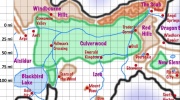 |
84 KB | Cayzle | A map of the middle of the Elennian Peninsula, with a 12.5 mi grid superimposed for use in mapping distances. | 1 |
| 01:23, 29 January 2014 | 2002WoldCon1.jpg (file) | 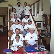 |
58 KB | Cayzle | Group photo from the WoldCon gathering in 2002. Here are, on the stairs (left bottom to left top, right top to right bottom): Matthew Hott (David's son), David Hott, Stephen Fleming, Steve Hott, Jerry Phelps, Kim McCoy, Scott Marley, Wade Alexander, Ted J | 1 |
| 17:56, 6 August 2013 | DreMoriaThb.jpg (file) | 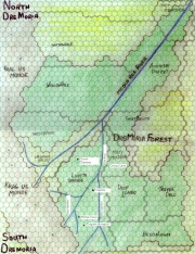 |
160 KB | Cayzle | A smaller version of the main DreMoria map. | 1 |
| 17:55, 6 August 2013 | DreMoria.jpg (file) | 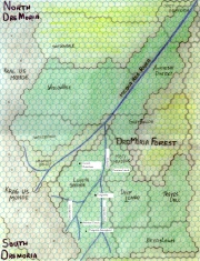 |
1.27 MB | Cayzle | A large high-res map of DreMoria | 1 |
| 05:51, 8 April 2012 | Southern-Yrth-8Apr12.jpg (file) |  |
125 KB | Cayzle | A map of the southern portion of the Continent of Yrth, showing those lands in which the civilization of New Elenna has spread, from Bonetown in the west to Brynn Baraz in the east. A scale showing miles in hundreds is included, with a selection of locati | 1 |
| 05:49, 8 April 2012 | Middle-Seas-8Apr12.jpg (file) | 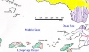 |
82 KB | Cayzle | A Map of the Middle Seas, with a scale showing miles in hundreds, from Bonetown to Osto. | 1 |
| 10:06, 8 July 2011 | SE-Yrth-3.jpg (file) | 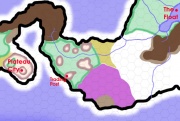 |
66 KB | Cayzle | A map of the lands between Plateau City and The Floating City, on a 25-mile-per-hex scale. On this map, white = plains and prairie; puke-tan-green = broken badlands and ashen desert; light brown = hills; dark brown = mountains; and forest green = forest. | 1 |
| 10:05, 8 July 2011 | SE-Yrth-2.jpg (file) | 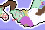 |
66 KB | Cayzle | A map of the lands between Plateau City and The Floating City, on a 25-mile-per-hex scale. On this map, white = plains and prairie; puke-tan-green = broken badlands and ashen desert; light brown = hills; dark brown = mountains; and forest green = forest. | 2 |
| 13:18, 20 May 2011 | Elennian-Peninsula.jpg (file) | 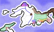 |
73 KB | Cayzle | This is a map of the Elennian Peninsula with a hex grid superimposed over it. One hex = 100 miles. | 1 |
| 14:20, 11 May 2011 | SE-Yrth-3b.jpg (file) | 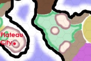 |
76 KB | Cayzle | The wilderness south and east of the Scab. Each hex is 25 miles. | 1 |
| 14:19, 11 May 2011 | SE-Yrth-3a.jpg (file) | 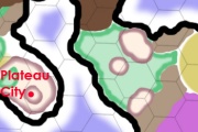 |
75 KB | Cayzle | The wilderness south and east of the Scab. Each hex is 50 miles. | 1 |
| 14:17, 11 May 2011 | SE Yrth 1.jpg (file) | 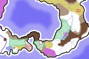 |
107 KB | Cayzle | A map of the southeast corner of the continent of Yrth. Each hex is 50 miles. | 1 |
| 16:53, 19 April 2011 | Brynbarazmap.jpg (file) | 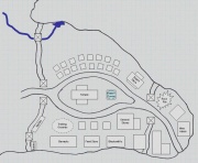 |
98 KB | Cayzle | A map of the new mining settlement at Bryn Baraz. | 1 |
| 04:28, 14 May 2010 | Hex Map of the Ellenian Peninsula.jpg (file) | 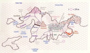 |
114 KB | Cayzle | This is a map of the Ellenian Peninsula with a hex grid overlaying it. The grid has a scale of 25 miles per hex. | 1 |
| 17:49, 7 April 2010 | Gatewaydownssmall.jpg (file) | 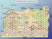 |
91 KB | Cayzle | A smaller map of the Gateway Downs | 1 |
| 17:48, 7 April 2010 | Gatewaydowns.jpg (file) | 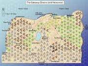 |
254 KB | Cayzle | A map of the Gateway Downs after the most recent Great Migration | 1 |
| 08:24, 17 November 2009 | BrynMap.jpg (file) | 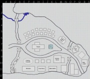 |
105 KB | Cayzle | Map of Bryn Baraz. | 1 |
| 17:05, 21 September 2009 | UnchartedLands.jpg (file) | 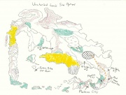 |
123 KB | Cayzle | Uncharted Lands Initial Map showing possible settlement locations | 1 |
| 09:33, 19 June 2009 | MinotaurIsland.jpg (file) | 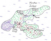 |
77 KB | Cayzle | A map of Minotaur Island. | 1 |
| 09:26, 19 June 2009 | CentaurIsland.jpg (file) | 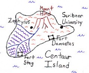 |
43 KB | Cayzle | A map of Centaur Island. | 1 |
| 08:49, 19 June 2009 | Taurisles.gif (file) | 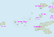 |
13 KB | Cayzle | A map of the Taur Isles. | 1 |
| 17:12, 25 March 2009 | 2009GreatMigration.JPG (file) | 77 KB | Cayzle | A map showing the before and after of the Great Migration. | 1 | |
| 09:22, 16 January 2009 | Aisildur sw.jpg (file) | 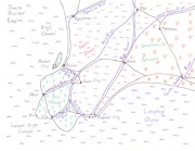 |
42 KB | Cayzle | Southwest Aisildur | 1 |
| 09:21, 16 January 2009 | Aisildur se.jpg (file) | 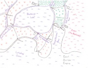 |
40 KB | Cayzle | Southeast Aisildur | 1 |
| 09:17, 16 January 2009 | Aisildur ne.jpg (file) | 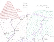 |
49 KB | Cayzle | Northeast Aisildur | 1 |
| 09:17, 16 January 2009 | Aisildur all.jpg (file) | 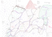 |
44 KB | Cayzle | All of Aisildur | 1 |
| 09:15, 16 January 2009 | Aisildur nw.jpg (file) | 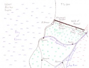 |
29 KB | Cayzle | Northwest Aisildur | 1 |
| 07:56, 29 August 2008 | Trash3.jpg (file) | 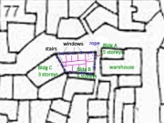 |
118 KB | Cayzle | Crimson Shields moving through an undead-plagued Trash Level of the Floating City. | 1 |
