| The new Woldipedia with 5e content is available here |
Yrth
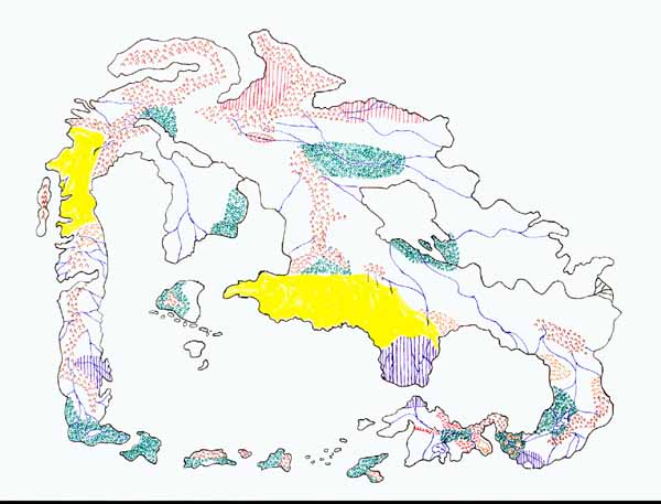
The Wold is composed of one large continent to the north, Yrth, a largely unexplored group of landmasses known collectively as The Vague Lands, and the mysterious shifting Southern Continent.
Some say Yrth looks like a celestial elephant balanced on its tail. Others seem to think that it is a crab with its pincers extended. Both views are foolishness.
As we zoom in closer, notice that the entire interior of Yrth is dark and featureless. This is the result of The Cataclysm of 400 years ago. Nothing lives there. The outlying areas to The North, West and South are still habitable. This makes for very crowded conditions in the south especially. When The cataclysm was imminent, peoples from every land settled/invaded (depending on your perspective) the peninsula on the end of the southeastern arm of Yrth in great numbers causing many principalities to live in an area where there was only one before: The peaceful Kingdom of Elenna. Now there are three major kingdoms, one empire, five known city-states and three-score minor kingdoms.
I know plenty about the Elennian Peninsula if you want to know more about a specific place.

